Mojave National Preserve
Share
Written by Sam Rober, Photography by Jon Pierce
Mojave National Preserve is often overlooked for its popular neighbor, Joshua Tree National Park. Mojave Desert hosts the largest Joshua Tree forest, sand dunes, cinder cone volcanoes and Springtime wildflowers. If you’ve driven from Las Vegas to Joshua Tree, you’ve likely passed through Mojave and may not have even known.
Driving into Mojave from I-40 displays a few Joshua trees and Granite Mountain. Every so often, a dirt road filters off somewhere into the desert just waiting to be explored. With some hesitation about rocky and pot-holed roads we pulled off and headed towards Granite Mountain to hike Silver Peak, an 8.5 mi. hike up a private land trail (known to be open to public). Unfortunately, we were greeted by no trespassing signs and unable to find a ‘safe’ place to enter. Shout out to anyone for tips on this! We turned away from the so-called trailhead and headed towards Kelso Dunes in search of a roadside campsite.
**Roadside camping here is found in multiple areas. A few in the Granite Mountain area, Kelso Dunes, Seventeen Mile point and Baker, and Black Canyon Road. Drive down the dirt road and look for a fire pit (rock laden). These designate the campgrounds. No permit needed. See below for more details on camping**
We set up in a campsite close to the Kelso Dunes. To our west, the Granite Mountain and to our East, the Kelso Dunes with entrance areas into the Dunes to explore at your leisure. After a couple miles of hiking around with our loaded up packs on (always practicing and adjusting how we pack and carry the weight) we found a back route into the Kelso Dunes. Wow! Immediately blown away by miles of rolling sand mountains cascading over the desert. Formed by howling winds whipping down through the desert valley into the dunes, they even give off a “boom” sound when any large amount of sand falls down.


Hiking to the top of a 500 ft. elevation gain sand dune doesn’t initially sound too difficult. Wrong. As you move, sand slips away and flows down as you sink in. But when you get the chance to climb the tallest sand dune in the area with almost no people around, you soak it in and keep going, more than once. The views from the top are impeccable. Rolling, untouched fields of sand waiting to be explored fading into the sunset, we took a few moments soaking the beauty in. Finding even more joy in the area, we ran down the dunes like little kids as the sand pushed away from our feet and filled our shoes until it looked like our feet were fat and swollen. Moments of pure joy, only to be returned to the next day.

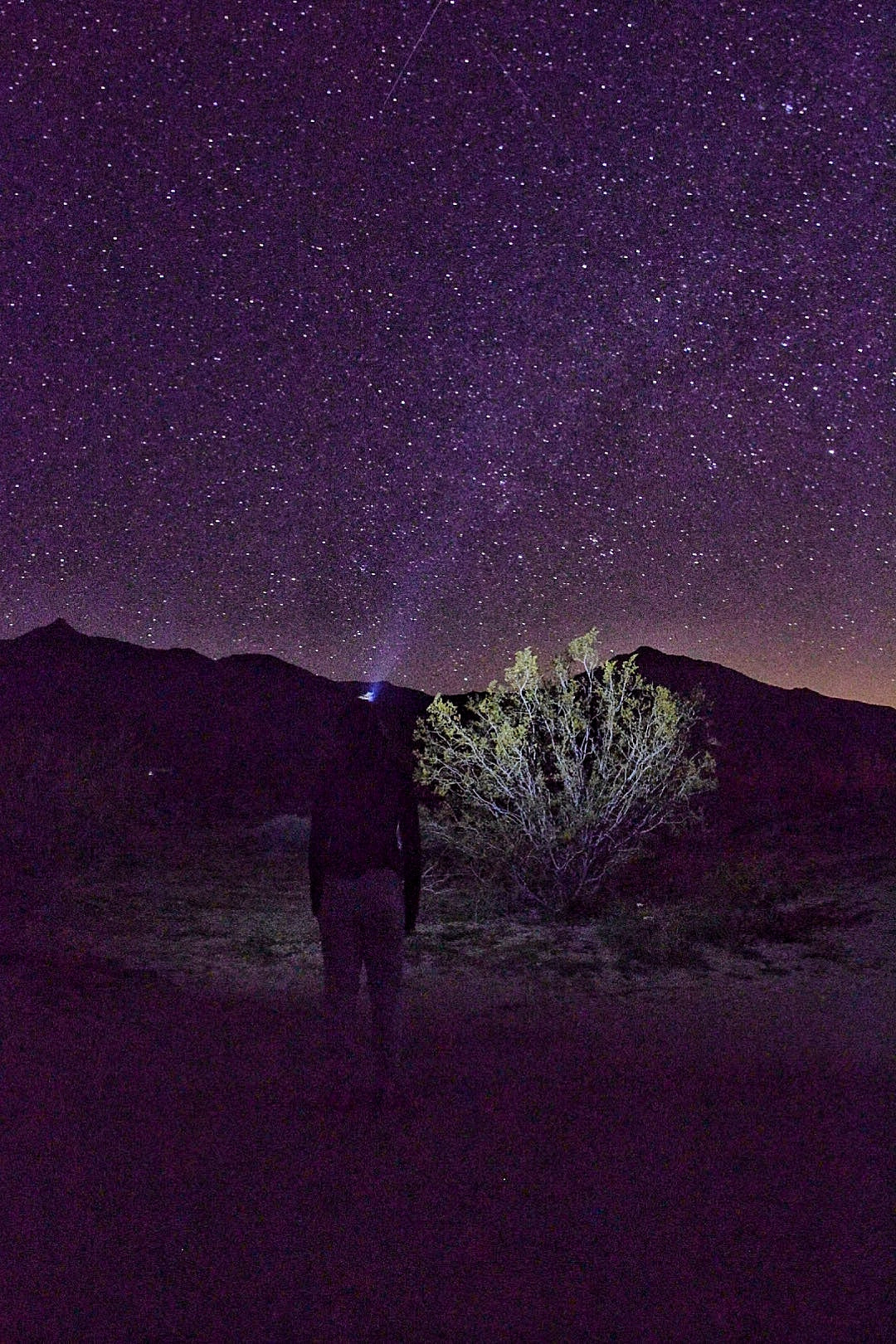
Back at camp, Jon and I are learning quite a bit about our Jetboil. Pro Tip: only boil water and pour into bowls or bags to cook food. Otherwise, your pot will have food stuck to it your entire trip. Oatmeal the next morning may taste like garlic herb rice! Whoops! While enjoying a cold beer and dinner overlooking the sunset on the dunes we find solace in silence and simple conversation and clear our minds of the pandemic happening around the world. Thankful to be able to wake up at night and see a clear sky full of stars. With these moments we slip into restless sleep ready for our early wake up call for sunrise.
5:30 AM the alarm goes off and we hop out of the tent. Sun seems to come up a bit faster in the desert. We head out to the back entry of the sand dunes and watch as the sun shades the west side of the dunes, lighting up the sky in luscious shades of yellow and orange. As the sun peaks over the mountains, it’s bright with no clouds reigning all its power. As we climb, we stop to watch (and to photograph). It’s quiet and brings serenity to the climb. Easily my favorite moment of the trip. As we reach the peak of the dune, the sun is in full force, rising and waking life. We should have stayed all week.


An area many people miss due to no signs about the location are the lava tubes. 5 miles down a pretty rough dirt path (we were nervous in a Subaru Crosstrek) is a small cave that boasts 1-2 lava tubes. As you enter through black volcanic rock and a short underpass (about 3 feet tall) you enter a musty small cave. After waddling through the pass way, within the cave is a strong shining streak of sun. Creating cascading beams of light that swirl through the caves dustiness, these tubes provide intrigue and a true natural phenomenon.

Feeling the desert heat, we decided to forgo hiking Teutonia Peak and headed on home. For some hiking and camping tips, check out the recommendations below!
Campsites
Campgrounds:
Mid Hills (no water) and Hole-in-the-wall Campgrounds: No reservations, first come-first serve, pit toilets and trash, $12 per night, max 8 people
Black Canyon Group Campground: Reservations required, vault toilets and trash, potable water, $25 per night
Roadside Camping:
These are previously used sites, and most cases can be sited by noting a rock or metal fire ring. All fires must be within the ring. NPS provides this map to help guide to these sites, I recommend just pulling off onto a dirt road
Granite Pass: off of Kelbaker Rd. About 6 miles north of I-40, head west on dirt access roads. Campsites are located scattered within. 4-wheel drive recommended here!
Kelso Dunes: Head down Kelso Dunes Road, a few scattered areas within a mile of the Kelso Dunes trailhead are the only camping in this area. These will likely be the toughest to get.
Seventeen Mile point (or rainy day mine site): 15.2 mi. Southeast of Baker off of Kelbaker Rd. Find the dirt access road (no sign), there are a few sites down this way. 4-wheel drive is recommended!
Sunrise Rock near Cima Rd.: Near Teutonia Peak trail, about 12 miles south of I-15.
Black Canyon Road: Probably the most east roadside camping near Hole-in-the-wall, there are a few locations here (about 4 miles apart from each other).
Backcountry Camping: Is allowed, as always, adhere Leave No Trace principles. Please view the NPS page for more detail.
Hikes and Points of Interest
Kelso Dunes: 3 mile roundtrip hike up sand, roughly 500 ft in elevation *See pictures above or in “photography”!
Silver Peak: 8.5 mi. roundtrip hike up in the Granite Mountains. 2,500 ft elevation gain to the peak at 6,365 ft. *Trail may now be closed to public, and quite tough to find
Teutonia Peak: 4 mile roundtrip hike crosses the Joshua Tree Forest and provides great views of Cima Dome. 700 ft. elevation
Lava Tubes: Down an unmarked 5 mile dirt path (very rocky, recommend 4-wheel drive). Very short hike, you climb down a stair ladder into a cave with lava tubes. You will need to duck under a short underpass. *See pictures above or in “photography”!
Hole-in-the-wall/Barber Peak Trail: Choose a short walk or a 1.5 mi loop or a 6 mile loop on the Barber Peak Trail. A must-see for all who visit! A short passageway with ring holds bring you into a small canyon with “holes in the wall” from a volcano eruption and ash dissipating leaving holes.
New York Peak: 7-9 mile roundtrip hike (pending your car) in the northeast corner of Mojave. Views of Pinto Valley and rock formations. 2,400 feet in elevation (7,533 ft. elevation at summit)
Fountain Peak: 5 mile roundtrip hike near the Mitchell Caverns. Technically outside of Mojave, you are rewarded with views of the Providence Range, Kelso Dunes and Silver Peak of Granite Mountain. Worth going off course outside of the Mitchell Caverns.
Mitchell Caverns (need ticket and is ranger led): Due to Covid-19, this was obviously not open. Please learn more about the caverns and tickets here.
Joshua Tree Forest and Cima Dome: near Teutonia Peak about 15 mi. off of I-15 lies the largest Joshua Tree Forest
Kelso Depot: Historic railroad depot in the middle of the park. You will go through this on Kelbaker Rd.
Soda Lake: A dry lake at the end of the Mojave River located off of Zzyzx Rd. Small pools of water form in the Spring and evaporate leaving deposits of sodium carbonate and bicarbonate. A pretty cool view!
As always, there is much more to explore in Mojave and surrounding areas!
-------------------------------
Read more from Sam & Jon's 'Life on the Move' here.
Share your comments & questions with us below!
